Export Georeferenced and Filtered Data in GeoSLAM Connect

Overview
This article explains how to export georeferenced and filtered/smoothed/decimated point cloud data in GeoSLAM Connect.
Procedure
Georeferencing can be achieved in multiple ways in Connect:
- Stop-and-Go Georeferencing workflow (this matches reference points to known control points within scans)
- Closed Loop Georeferencing workflow (this matches the trajectory of the ZEB Horizon system with the trajectory of a GNSS receiver - this combination is included as the ZEB Locate system)
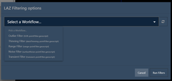
A georeferenced LAZ file is produced using either workflow. This LAZ file can then be filtered using the data filtering tools within Connect - these can be found in the top taskbar in the software.

Once a filter is applied, a new LAZ file is produced meaning that point clouds can be georeferenced and filtered within GeoSLAM Connect.