Release Notes for FARO Zone 2D

Overview
This article lists the Release Notes for each version of FARO Zone 2D Software to date. The current version release notes are displayed at the top of the article. Previous revisions are contained in expanding sections below.
Navigating this article:
- Use the Table of Contents block in the upper right hand of this article to jump to a release.
- You can expand a version section by clicking the + button
- To search all versions, click the Expand All Versions button and then use the Ctrl+f search feature in your browser. Sections must be “expanded” to be searched.
FARO Zone 2D 2026.5.0504 - May 2026
What’s new for 2026
Evidence Markers 2.0
- Multiple file attachments
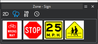
Signs Library
- Quick pick for most common signs
- Sign search – search only signs for quick access
Quick Report Tool
- Ensures all elements get placed in the working environment – and ultimately the report
FARO Zone 2D 2025.10.1014 - October 2025
Hot patch – Fixed snapping issues
FARO Zone 2D 2025.10.1009 - October 2025
What’s New – Move right into Prime Workflows just by clicking on the Start page “Pick Data Type” picture (2nd tile).
Important Fixes Quick Review
- Evidence
- Attach multiple files to an evidence placard
- Works with Layer Report
- Workflow Updates
- Bing Map Load
- CDT Units Issue
- Large jpg file support
Prime Workflow System
https://farotechnologies.mcoutput.com/faro_zone_2d_help/en-us/Default.htm#Home/Workflow_Center.htm
Favorites Toolbars
https://farotechnologies.mcoutput.com/faro_zone_2d_help/en-us/Default.htm#Symbols/Favorites.htm
Quick Report Tool
https://farotechnologies.mcoutput.com/faro_zone_2d_help/en-us/Default.htm#Symbols/Quick_Reports.htm
Image Clean-Out (watch movie)
https://faroassist.com/media/339094b5-ac57-4e86-b773-9af09cb85bfd/
Back-Ups Manager
Bug Fixes
- FZ3-12814 Layer Report - extending the drawing area to fill the page in legal rather than letter
- FZ3-12808 Workflow / Favs translations out/in
- FZ3-12795 UI - Table - Evidence marker Attached Files - Table is setting the spacing wrong
- FZ3-12793 CDT - Altus RAW Meter unit not converting correctly
- FZ3-12781 Favorites 2D - reset issues
- FZ3-12780 Print Snapshot - With Form Not rendering properly
- FZ3-12776 Evidence Marker - Multi-Select files during attach
- FZ3-12775 Evidence Marker - Add Option to ignore Shadows
- FZ3-12773 HUD - Right Align - Play Button issue
- FZ3-12772 Canvas resize causes error.
- FZ3-12771 Legend Tool - Update Issue GDI
- FZ3-12770 Evidence Marker - Report - Make sure it handles multiple file references
- FZ3-12768 Evidence Marker - Allow adding multiple referenced files
- FZ3-12762 Bing Map account updated
- FZ3-12760 Select image after placed from Ortho Density Map
- FZ3-12756 UI - Right Align - Convert Panel going to left
- FZ3-12755 UI - Right Align - Mouse Dead space issue
- FZ3-12749 Favorites - Add highlight to used commands
- FZ3-12747 Quick Report - when opening Quick Report stuff isn't being placed automatically
- FZ3-12746 Quick Report - going to 2D the screen is black
- FZ3-12745 Quick Report - North arrow will disappear
- FZ3-12740 2D - HUD Align Right - Issue with initial draw size
- FZ3-12738 HUD - Right Align - Issue with collapsible
- FZ3-12737 Quick Report - 2D North Arrows
- FZ3-12733 Quick Report - first time does not include scalebar, north arrow in the extents
- FZ3-12732 For Patch - Quick bubble label HUD
- FZ3-12731 For Patch - Quick Report - North arrow and scalebar, and legend to in Save Load
- FZ3-12724 Favorites - move left/right not working on this button - see attachment
- FZ3-12707 Vehicle DB, clean make given for year.
- FZ3-12705 Legend - Bubble Label - Add option to use Bubble Label items as evidence markers in legend tool
- FZ3-12702 Quick Report - can't erase the Scalebar. Users might try to delete a North arrow or scale bar or legend.
- FZ3-12701 Quick Report - Layer with bad extents
- FZ3-12700 Quick Report - Create Toggle for legend
- FZ3-12690 Point UI - can't change Point type on-the-fly when placing a point. dialog has to be closed and reopened to see new point style selection.
- FZ3-12684 Print Snapshot - Doesn't include the print form like the normal print
- FZ3-12534 Parking Lot - Change Line color not updating to black in 3D when reset
- FZ3-12466 Snapping - Perpendicular - Investigate the AllowSnap property
FARO Zone 2D 2025.7.0710 - July 2025
What’s New – Move right into Prime Workflows just by clicking on the Start page “Pick Data Type” picture.
Prime Workflow System
https://farotechnologies.mcoutput.com/faro_zone_2d_help/en-us/Default.htm#Home/Workflow_Center.htm
Favorites Toolbars
https://farotechnologies.mcoutput.com/faro_zone_2d_help/en-us/Default.htm#Symbols/Favorites.htm
Quick Report Tool
https://farotechnologies.mcoutput.com/faro_zone_2d_help/en-us/Default.htm#Symbols/Quick_Reports.htm
Image Clean-Out (watch movie)
https://faroassist.com/media/339094b5-ac57-4e86-b773-9af09cb85bfd/
Back-Ups Manager
Bug Fixes
- FZ3-12552 Backups Manager - add options in the hamburger
- FZ3-12545 Backups Manager - better exit message box if file previewed but not restored
- FZ3-12520 Backups Manager - Show fzproj size in the grid - showing 0 Bytes now
- FZ3-12518 Backups Manager - Sort by name instead of date. Name will always have a date stamp
- FZ3-12505 Backups Manager popup message when hovered over a file - click to preview
- FZ3-12495 Do not Save Backup after a Tiled Image is finished being created. Very annoying
- FZ3-12551 Layer Mgr. - When selecting multiple objects in the layer mgr. show them selected on screen - currently only one selects on screen
- FZ3-12516 Layer Mgr. - r-click, new layer, + disappears
- FZ3-12542 Image Cleanout - better exit message when image hasn't been saved
- FZ3-12529 Image cleanout Workflow - blank lines
- FZ3-12453 Image cleanout tool - implement new vehicle profile detection
- FZ3-12508 Research - Image Cleanout - Flood Select to Not Require Thresholding
- FZ3-12471 Parking lot HUD. down arrow stall width to 0 causes massive hangup
- FZ3-12468 Parking Lot line type- Default Lines to Black instead of white
- FZ3-12546 Fix Major Update dynamic test of License
- FZ3-12504 Update patch user experience. Force shutdown
- FZ3-12474 Provisional Key message going behind when I launched 2024
- FZ3-12533 LEGEND UI HUD - EXPERIMENTAL show control
- FZ3-12503 Match text with arrow - it shouldn't move the position of the arrow.
- FZ3-12489 704 Placard - Sizing issue in 2D with letters
- FZ3-12488 workflow dlc updates
- FZ3-12462 Evidence Marker - Add an option to create legend to the evidence marker UI
- FZ3-12461 Legend - Setup orientation values to increment by 45 on the major and by 1 on minor values
FARO Zone 2D 2025.4.0422 - April 2025
What’s New – This is the first patch release of Zone 2D 2025 and includes some exciting updates to the Image Clean-Out tool and Backup Manager and more great updates.
Image Clean-Out (watch movie)
https://faroassist.com/media/339094b5-ac57-4e86-b773-9af09cb85bfd/
Back-Ups Manager (watch movie)
https://faroassist.com/media/dda52589-3737-4368-b582-66b28261d402/
Bug Fixes
- FZ3-12552 Backups Manager - add options in the hamburger
- FZ3-12545 Backups Manager - better exit message box if file previewed but not restored
- FZ3-12520 Backups Manager - Show fzproj size in the grid - showing 0 Bytes now
- FZ3-12518 Backups Manager - Sort by name instead of date. Name will always have a date stamp
- FZ3-12505 Backups Manager popup message when hovered over a file - click to preview
- FZ3-12495 Do not Save Backup after a Tiled Image is finished being created. Very annoying
- FZ3-12551 Layer Mgr. - When selecting multiple objects in the layer mgr. show them selected on screen - currently only one selects on screen
- FZ3-12516 Layer Mgr. - r-click, new layer, + disappears
- FZ3-12542 Image Cleanout - better exit message when image hasn't been saved
- FZ3-12529 Image cleanout Workflow - blank lines
- FZ3-12453 Image cleanout tool - implement new vehicle profile detection
- FZ3-12508 Research - Image Cleanout - Flood Select to Not Require Thresholding
- FZ3-12471 Parking lot HUD. down arrow stall width to 0 causes massive hangup
- FZ3-12468 Parking Lot line type- Default Lines to Black instead of white
- FZ3-12546 Fix Major Update dynamic test of License
- FZ3-12504 Update patch user experience. Force shutdown
- FZ3-12474 Provisional Key message going behind when I launched 2024
- FZ3-12533 LEGEND UI HUD - EXPERIMENTAL show control
- FZ3-12503 Match text with arrow - it shouldn't move the position of the arrow.
- FZ3-12489 704 Placard - Sizing issue in 2D with letters
- FZ3-12488 workflow dlc updates
- FZ3-12462 Evidence Marker - Add an option to create legend to the evidence marker UI
- FZ3-12461 Legend - Setup orientation values to increment by 45 on the major and by 1 on minor values
FARO Zone 2D 2025.3.0317 - March 2025
Upgrade – Now available, Zone 2D 2025
Zone 2D 2025 gives you all the tools you need to easily create 2D reports for crash, crime and fire scenes.
- Automatic Legend Tool
- Advanced Image Clean-Out with A.I. Vehicle Detection
Bug Fixes
- FZ3-12437 Axon message cut off. Add link to PDF docs
- FZ3-12410 Image Cleanout - Polyline seems to be losing the point - cuts off selection
- FZ3-12409 Selected boxes not showing selecting - lost the dashed boundary
- FZ3-12399 Workflow - Look into word wrapping on cells
- FZ3-12398 Workflow - make the selected row blue color "lighter"
- FZ3-12397 Workflow - Only increment one row at a time. Don't skip to next main command
- FZ3-12388 Snaps - Ortho Snap - 2D if all snaps are turned off also turn off the ortho snap
- FZ3-12381 Workflow - Allow right click on left panel actions
- FZ3-12380 Legend - Add Positioning controls to left panel HUD
- FZ3-12372 Tiled Image - make it work with new cleanout tool. Match Image Object functionality.
- FZ3-12371 Legend - Setup default padding for the symbol
- FZ3-12352 Print Preview - Make the fields larger so the horizontal scroll bar isn't as useless
- FZ3-12312 Rectangle - Dashed Lines - Difference between the 2D render and the print preview
- FZ3-12300 Snaps ON pop up message is incorrect
- FZ3-12282 Image right click menu - Import/Export commands (Images and Satellite)
FARO Zone 2D 2024.15.0310 - March 2025
This release updates license checking functions to accommodate upgrades to the upcoming 2025 version.
FARO Zone 2D 2025.14.0212 - February 2025
Bug Fixes
- FZ3-12323 Translations - refresh
- FZ3-12322 Ribbon - Main Menu Dropdown - Remove Print Form
- FFZ3-12303 Lines - Tiled Item - Setting spacing to zero crashes
- FZ3-12298 Legend - Add padding to the paragraph icon
- FFZ3-12274 Curves - Convert To - Curbs - Not calculating the curve points properly
FARO Zone 2D 2024.12.1212 Patch - December 2024
Hot patch for symbol loading issues.
FARO Zone 2D 2024.12.1204 Release Notes - December 2024
Updates
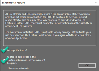
A.I. Image Clean-out System (Experimental)
Watch video here.
The A.I. Image Clean-Out system is part of our experimental (pre-release) features. Check both boxes!
- Select Image: Choose any image to clean out (satellite, ortho image, or photo).

- Open Clean-Out Tool: Click on the Clean-Out Image tool from the Satellite Map properties panel.
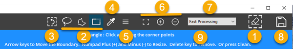
- A.I. Vehicle Detect
 (Switches to Clean-Out tool when items are selected)
 - Selection Tools – Lasso (freeform), Polygon, Rectangle
- Undo selected boundaries
- Sample Boundary creator
- Pull-down (r-click) menu
- Zoom tools
- Process quality and speed
- Save changes
- Tooltip Message Center
- A.I. Vehicle Detect
- Automatically Find Vehicles (if applicable):

- Click on the Automatically Find Vehicles tool to identify cars.
- Vehicles will be highlighted with a red boundary box.

- Select Vehicles:
- Click inside any red boundary box to select it.
- Use arrow keys or num pad +/- keys to reposition or resize the selection.

- Clean Image: Click on the Clean Image tool to remove the selected vehicles.
Note: The cleaned area will blend with the surrounding image. - Use Sample Boundary (optional):

If you want a specific pattern, create a Sample Boundary using the Sample Boundary Tool. - Undo/Redo:

- If you're not satisfied with the results, click Undo Last Clean-Out.
- Click again to switch to Redo for comparison.
- Higher Quality Clean (optional):

Consider selecting a higher quality clean for better results, though it may take longer. - Clean Other Objects:
Use any of the bounding tools (Rectangle, Polygon, Freeform) to select additional objects.

Click on the Clean Image tool again after selecting. - Final Save: Once the cleanup is complete, click the Save button to save your changes.
Tips
- Always check the blending of cleaned areas with the surrounding image for a natural look
- Experiment with different bounding tools for various object shapes
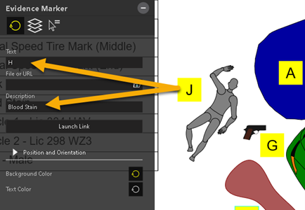
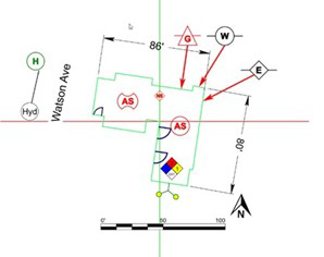
Legend Tool (Experimental)
Automatically create a Legend from all evidence placards "Title Text" and "Description" fields. The Legend Tool is part of our experimental (pre-release) features. Check both boxes!
Manual - Legend
Add evidence markers (placards) to the diagram along with descriptions. To create the legend to insert into the diagram, click on the Legend tool from the Power Tools ribbon.

Place the Legend in the diagram.
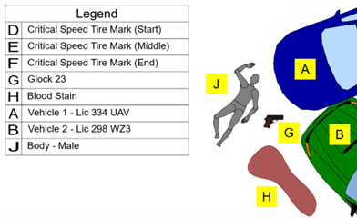
Select the Legend to open the Legend properties panel.

(1) Edit the Legend title
(2) Scale the Legend to best fit in the diagram
(3) Edit the Legend - Change Marker and Description values and remove rows
(4) Refresh if you make changes
(5) Create a Legend Report - Click to create a report of the Legend with title bar
(6) Legends can be "Saved" and "Loaded" for use in other drawings
Bug Fixes
- FZ3-12230 Image - Cleanout Tool
- FZ3-12215 Dimension Line SL - Fix Percent Issue
- FZ3-12197 oneway signs - fix outline
- FZ3-12169 Z2g: Legend support
- FZ3-12168 Z2g: BubbleLabel link support
- FZ3-12189 MS PDF Wall print issue
- FZ3-12181 Legend - Title Size not saving / loading
- FZ3-12175 Symbol / AWS denied message
- FZ3-12163 Axon - Arkansas Fish and Game - not seeing download list - Increment
- FZ3-12160 Favorites - localizations
- FZ3-12151 Airboats
- FZ3-12136 Legend - Add header to the report
- FZ3-12228 Z2g non point cloud issue
FARO Zone 2D 2024.10.1022 Release Notes - October 2024
Updates
Click on the link to learn more!
Legend Tool (Experimental)
Automatically create a Legend from all evidence placards "Title Text" and "Description" fields. The Legend Tool is part of our experimental (pre-release) features. Check both boxes!
Manual - Legend
Add evidence markers (placards) to the diagram along with descriptions. To create the legend to insert into the diagram, click on the Legend tool from the Power Tools ribbon.
Place the Legend in the diagram.
Select the Legend to open the Legend properties panel.
(1) Edit the Legend title
(2) Scale the Legend to best fit in the diagram
(3) Edit the Legend - Change Marker and Description values and remove rows
(4) Refresh if you make changes
(5) Create a Legend Report - Click to create a report of the Legend with title bar
(6) Legends can be "Saved" and "Loaded" for use in other drawings
Bug Fixes
- FZ3-12083 Selecting Item - dual selection issue in list
- FZ3-12074 Translations German
- FZ3-12066 Axon - unnamed drawing, upload, name fz project - it's weird
- FZ3-12059 Install - Reboot - License Manager
- FZ3-12058 HUD / Line Types / consistency
- FZ3-12057 Start Page - click Update Available yellow image bring up Updates form
- FZ3-12055 DLC - update / paint
- FZ3-12053 Guardrail does not have a convert
- FZ3-12043 Test snapshot with Tiled Image and in Zone 2D build
- FZ3-12042 Snapshot tool crashes when image object in the drawing (in 2D view)
- FZ3-12039 FARO Assist - Training playlist - fix pptx (pdf and image in assets)
- FZ3-12031 DLC Refresh 2024.8
- FZ3-12019 Image Scale issue
- FZ3-12003 Axon - Fix login experience
- FZ3-11997 FaroAssist display placeholder images if the tile image fails to load
- FZ3-11979 Deleted - Polyline - Snap Perpendicular - Not getting double perpendicular snap
- FZ3-11488 DXF Import - add to Unit Scale form
FARO Zone 2D 2024.8.0819 Release Notes - August 2024
Updates
Click on the links to learn more!
Bug Fixes
- FZ3-12006 Axon Connect - Add cancel sign in and async
- FZ3-11950 Axon request - upload a PDF (saved drawing)
- FZ3-11703 Axon 2.0 Implement Download
- FZ3-11802 Axon 2.0 Implement Upload
- FZ3-11794 start Line, select linetype, r-click on linetype crash
- FZ3-11777 Crash error exception form not resizing correctly
- FZ3-11998 Rectangle - 3pnt Draw - Spacebar repeat - not going back to 3pnt rectangle draw
- FZ3-11968 Arc line type menu corner selection only
- FZ3-11736 Arc - Arrow gap in line - Reduce to make sure there isn't a gap in 2D
- FZ3-12010 Z2go: scanner data not exported if scanner not visible
- FZ3-11988 fix Zone 2D file filters - kill HD, Reality, Lsproj
- FZ3-11982 Preferences, color pick, z2g measure, reset wording
- FZ3-11963 Preferences - Add option to delete all preferences
- FZ3-11974 clean Language list prefs
- FZ3-11787 Workflows - Create New - Adding North Arrow Symbol - Causes some sort of error
- FZ3-11884 Add Workflow Center to Search. Rename Workflows to Workflows Help Manual
- FZ3-11905 Workflows - translation - investigate
- FZ3-11820 Workflows - Setup print and export to csv on customer workflow UI
- FZ3-11635 Workflows - Create an ani-buddy workflow
- FZ3-11940 Favorites Toolbars filter out 3D toolbars for Zone 2D
- FZ3-11944 Z2g: Failed to create pano image error message
- FZ3-11929 Z2g: Scanner location offset in merged point cloud
- FZ3-11943 Layer Manager. Toggle on/off needs zoom to refresh
- FZ3-11923 Ortho tool tips / state
- FZ3-11921 Dimension Angle - Custom Text - 2D Mode not working in release
- FZ3-11908 Grips-option to be more visible
- FZ3-11894 Print Form - If you print from a page other than the first it doesn't print the whole report
- FZ3-11862 Romanian Road Signs
- FZ3-11857 Structure - corners are "chamfered in print
- FZ3-11854 Rotate 2D symbol in Zone 3D while placing. Not showing new rotation
- FZ3-11851 Vehicle Specs - vehicle box dimensions not matching HUD values
- FZ3-11849 Preferences - scroll down a page then exit. You can never scroll to the top of that page again
- FZ3-11833 Test Axon Auto Refresh Credentials
- FZ3-11831 DblClk to copy - setting to turn it off – r-click menu too
- FZ3-11825 Dimension Angle - Custom Text needs to hide the angle value on the dimension angle - like dimension line
- FZ3-11822 Zone 2D - place symbol and rotate during placement. Selection rotates but not vehicle until zoom
- FZ3-11801 AS Lite Vehicle Database 2024
- FZ3-11791 Backups not restoring previous drawing if it was unnamed.
- FZ3-11686 Print - Form - Setup so that in print form it uses only the form layer for scaling
- FZ3-11676 Deploy Faro Assist 2.0 to Production
- FZ3-11520 DXF save 2D vehicle - lose too much geometry. Fills and poly's missing
FARO Zone 2D 2024.2.0226 Release Notes - February 2024
Updates
Performance Improvements:
- Optimized clipping and rendering. 10x faster when starting a new scene from within Zone.
- Text, paragraphs, and label position and padding have been perfected to align on-screen in the 2D and the print dialog.
- Text center snap added.
- Text border padding option added.
Bug Fixes
- FZ3-11587 Ribbon - Close button not working on right side of the button
- FZ3-11576 Symbol Load - Symbol Protractor Issue
- FZ3-11566 Bubble Label HUD Zone 2D - remove Text size
- FZ3-11553 Fix Bubble Label Text Render 2D
- FZ3-11546 Fix Bubble Label Text Render GDI (print dialog)
- FZ3-11538 Symbol - Transparency - Not working in GDI Print dialog
- FZ3-11535 Optimize Pick2D for Key Geometries
- FZ3-11534 PolyCurve Rendering Improvements
- FZ3-11531 Fixed Title Bar Move Before Render Crash
- FZ3-11522 Undo text properties
- FZ3-11521 Clipping Tiny objects too aggressive on Lines
- FZ3-11517 Favorites - Place symbol does not go to the History
- FZ3-11514 FZ2 Report Center Z2g launch crash
- FZ3-11513 DXF save symbols bug
- FZ3-11512 import/export icon Zone 2D
- FZ3-11506 Google Maps blue box - when nothing in Save location list
- FZ3-11480 Test - CDT - Points and text size wrong in print form
- FZ3-11472 Optimize 2D Clipping
- FZ3-11390 ca 555 forms - Revisit placements
FARO Zone 2D 2024.1.0124 Release Notes - January 2024
Bug Fixes
- FZ3-11489 GeoTIFF generation optimization
- FZ3-11464 Print to Arch C with FARO Zone Driver
- FZ3-11418 Printing - If there is a print form always use print form rather than having both normal print and print form options
- FZ3-11455 Report Center - Layer Report Issue with print form closing automatically
- FZ3-11438 Layer Mgr report needs tooltip
- FZ3-11414 Report Center - Add Zone 2 Go
- FZ3-11444 Scalebar - Variable Small Increments 2D
- FZ3-11392 Scalebar - Not automatically changing units in 2D
- FZ3-11441 Vehicle Spec, record count issue
- FZ3-11450 CDT import dxf point
- FZ3-11424 Mag Window - Airplane mode not working - doesn't display full drawing but panning inside works
FARO Zone 2D 24.0.1215 Release Notes - December 2023
Updates
Favorites Tool – Workflow Toolbar System
The Favorites tool allows you to add (and remove) features, symbols, models, or signs to a scalable toolbox. Preset and saved custom toolbars can be loaded on-the-fly for various project types. Any custom toolbar can be modified on-the-fly, and you can easily create new ones.
Favorites (click here)
Match and Clone
Use the Match Object tool to replicate the properties of a selected object so that you can reuse the object and its properties elsewhere in your drawing. Double-click an object to Clone its properties and draw or place the object if it’s a symbol or model.
Match and Clone Objects (click here)
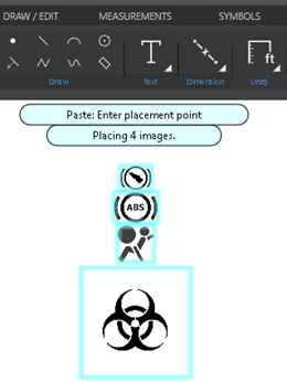
Copy/Paste Multiple Images
From Windows File Explorer, you can select and copy (Ctrl+C) multiple images, and then paste (Ctrl+V) them in your drawing.
Copy/Paste Multiple Images (click here)
A.I. Vehicle Detection and Image Clean-Up
The satellite image clean-up tool just got a whole lot easier and more fun! This tool uses A.I. functionality to automatically detect and select vehicles in the satellite image. The clean-up tools have also been updated and simplified.
A.I. Vehicle Detect and Image Cleanup (click me)
DXF/DWG 2018 – Import/Export Latest DWG Format
The AutoCAD™ drawing format is used worldwide to share CAD diagrams. 2018 is the latest iteration of this format.
FARO License Manager 2.0
The new License Manager replaces the previous browser-based version to allow you to easily manage your licenses.
Applying a license to your installation of FARO Zone 2D (click here)
Bug Fixes
- FZ3-11376 CA 555 forms
- FZ3-11349 Rectangle UI - Setup Length so that it's the value pointing to the rotation grip
- FZ3-11348 Ellipse Select - Fix issues with corners
- FZ3-11332 Select Area - Tool Tip changing to wrong one during move
- FZ3-11329 Signs - reverse localize Chinese
- FZ3-11319 Multi-Select - On Intersection - Won't allow selecting multiple models
- FZ3-11304 Chevron N Arrow fill
- FZ3-11293 Selection - Crossing - Make it dashed
- FZ3-11290 Multi select - dash selection window for crossing
- FZ3-11267 CZD issue Multi-line text not positioned correctly
- FZ3-11266 Roadway Arc - Lines set to hidden are still shown
- FZ3-11200 Orthophoto scale issue
- FZ3-11060 Orthophoto generation performance improvement
- FZ3-11180 Polycurves in 2D slow down when zooming in with lots of vertices
- FZ3-11075 Zone 2D remove Text button from Quickbar
FARO Zone 2D 2023.9.0907 Release Notes - September 2023
Updates
Performance and Optimization and Stability Work
Bug Fixes
- FZ3-11223 Lose keyboard after eyedropper used.
- FZ3-11192 FORMS, add, green margins, "X" for text, default OFF.
- FZ3-11153 Curve - Offset - Custom Control Grips offset issue.
FARO Zone 2D 2023.8.0817 Release Notes - August 2023
Updates
Match and Clone
 Use the Match Object tool to replicate the properties of a selected object so that you can reuse the object and its properties elsewhere in your drawing.
For example, if you are creating a road drawing and you make a dashed road line that you'll need to reuse in other parts of the drawing, you can use the Match Object tool to replicate the properties of the dashed line.
You can use the Match Object tool for many objects in your drawing, including lines, labels, dimension arrows, shapes, etc. You also use it to duplicate symbols and models.
To use the Match Object command:
 The Match tool appears in the HUD after you use a tool, or after you select an object.
- Select the object to modify, and then click the Match tool from the HUD. The F2 key also launches the Match tool.
- Click the object from which you want to duplicate properties.
- The selected object inherits the properties of the second object that you selected.
Clone (Double-click)
Double-click an object to clone its properties and draw or place the object if it’s a symbol or model.
Clone (Spacebar)
Select an object and then hit the Spacebar. This command clones the properties of the selected object and starts drawing the entity.
Why use the Spacebar instead of double-clicking?
- Double-click text to open the text edit dialog. Click the Spacebar to start drawing text that matches the selected text.
- In detailed drawings, it can be difficult to double-click an object. It’s easier to zoom in on the object, select it, and then hit the Spacebar to draw the object that matches the properties of the selection.
Bug Fixes
- FZ3-11182 Zone2go Overview map boundary issue
- FZ3-11179 Zone2go output folder validation
- FZ3-11181 Fire_Forms_Fixes
- FZ3-11175 Label Draw - Select Textbox after draw
- FZ3-11159 Start page "Register" label has the g cut off.
- FZ3-11154 Bubble Label - dblclk not picking up text.
- FZ3-11127 Arc - UI - Tooltips on pbr material box
- FZ3-10889 Symbols - Add option for single paint color
- FZ3-11007 Symbols - Create - Doesn't automatically generate an icon
FARO Zone 2D 2023.8.0801 Release Notes - August 2023
Updates
Match and Clone
Use the Match Object tool to replicate the properties of a selected object so that you can reuse the object and its properties elsewhere in your drawing.
For example, if you are creating a road drawing and you make a dashed road line that you'll need to reuse in other parts of the drawing, you can use the Match Object tool to replicate the properties of the dashed line.
You can use the Match Object tool for many objects in your drawing, including lines, labels, dimension arrows, shapes, etc. You also use it to duplicate symbols and models.
To use the Match Object command:
The Match tool appears in the HUD after you use a tool, or after you select an object.
- Select the object to modify, and then click the Match tool from the HUD. The F2 key also launches the Match tool.
- Click the object from which you want to duplicate properties.
- The selected object inherits the properties of the second object that you selected.
Clone (Double-click)
Double-click an object to clone its properties and draw or place the object if it’s a symbol or model.
Clone (Spacebar)
Select an object and then hit the Spacebar. This command clones the properties of the selected object and starts drawing the entity.
Why use the Spacebar instead of double-clicking?
- Double-click text to open the text edit dialog. Click the Spacebar to start drawing text that matches the selected text.
- In detailed drawings, it can be difficult to double-click an object. It’s easier to zoom in on the object, select it, and then hit the Spacebar to draw the object that matches the properties of the selection.
Bug Fixes
- FZ3-11109 Match if miss object pick stay in command
- FZ3-11107 HUDs show Match icon after command complete
- FZ3-11103 Bubble Label GDI - re-fix
- FZ3-11102 Favorites - remove Signs button - add to favorites go to 3D
- FZ3-11094 GPS pin - Z-fighting after move and snap 3D
- FZ3-11073 Roadway - Single Line - Can't change sidewalk color
- FZ3-11071 Ribbon - Line Break Tool not working properly
- FZ3-11059 Start page - Pin, Move to front, Favorites - same UI as Favorites tile (Paul)
- FZ3-11058 Transfer Properties - Match object to transfer properties. Add match icon to HUDs
- FZ3-11057 Match Circles not matching all properties (Fill, thickness)
- FZ3-11056 Double click single bubble label picks the 1/n method
- FZ3-11046 Intersection - Arc Tangent - Creating black lines
- FZ3-11021 Snapshot Tool - Needs option to fill background
- FZ3-11011 GPS Pin - Add Facing Option
- FZ3-11000 GCP Marker panel: select and zoom in
- FZ3-10998 GCP marker auto scale
- FZ3-10891 Z2g dialog facelift
FARO Zone 2D 2023.6.0622 Release Notes - June 2023
Updates
Match Object 
Use the Match Object tool to replicate the properties of a selected object so that you can reuse the object and its properties elsewhere in your drawing. For example, if you are creating a road drawing and you make a dashed road line that you'll need to reuse in other parts of the drawing, you can use the Match Object tool to replicate the properties of the dashed line.
You can use the Match Object tool for many objects in your drawing, including lines, labels, dimension arrows, shapes, etc.
To use the Match Object command:
- Select an object in the drawing that you'd like to re-use.
- From the quickbar, or from the Draw/Edit ribbon, click Match Object
 .
. - Draw or edit the object.
Note: To re-use objects in multiple drawings, use the Favorites tool.
Center Scene on Point Tool 
The Center Scene on Point tool allows you to quickly re-origin your diagram to the center (0,0) of the drawing grid. For example, you could have an area of the drawing with locked layers, and if you move an object in one of the layers, the objects in the other layers are not moved along with the object that you selected.
To re-origin your drawing:
- From the Draw/Edit ribbon, click Center Scene on Point.
- Find the point that you want to designate as the center of the drawing.
- Click the point. The drawing (including the hidden layers) re-orients at that point.
- When you display all of the layers from the Layer Manager, you will see that everything in the drawing is repositioned.
Bug Fixes
- FZ3-11030 Explode group does not maintain scaling of linetyped objects
- FZ3-11028 Match Arcs not remembering linetypes
- FZ3-11024 Group not showing HUD toolbar
- FZ3-11020 Ribbon - Align Icon - Wrong Icon
- FZ3-11015 Unable to Reproduce - Chamfer / Fillet - throwing error on undo and cancel
- FZ3-11013 Unable to Reproduce - Fillet - Cancel - Crashes in 2D Mode
- FZ3-10989 Match command - F2, Rclick, selected and non-selected objects
- FZ3-11045 Match - Single line scuff launches polyline tool - same for yaw mark and critical scuff
- FZ3-10992 colorpicker - paste hex color doesn't update
- FZ3-10976 Open File from Start Page then leave Zone, come back and Open Dialog is behind
- FZ3-10975 Remove Dim Label from Dim options in Quick Ribbon - 2D
- FZ3-10974 Area - remove auto size and move Font Size only to main options - 3D/2D
- FZ3-10973 Favorites in HUDs - remove all Heart icons
- FZ3-10960 DWG issue - creates a zero pt continuous line
- FZ3-10953 AS Lite Vehicle Database / CARSP
- FZ3-10948 Rename "Print Snapshot" to "Create Snapshot" - FZ2D
- FZ3-10947 Quick Ribbon Polycurve - arrows draw with Polyline
- FZ3-10946 Flex lines need custom curve option - poly curves
- FZ3-10945 Arc - arrow linetype from Quick ribbon not working
- FZ3-10944 Intersection HUD - Median color tiny
- FZ3-10937 DWG 2018 - error message direct user to TrueView (link)
- FZ3-10912 Image Draw - Localize the Tile image Message
- FZ3-10908 Ribbon - Import Export Dropdown - Fix for legacy and Pro
- FZ3-10902 Rectangle Draw - 3pnt - Lag During draw
- FZ3-10900 Road Line - Save / Load - Side walk save
- FZ3-10890 Drawing - Re-Origin Tool
- FZ3-10886 Bubble Label updates
- FZ3-10885 Virtual Survey - 2D HUD doesn't match 3D HUD
- FZ3-10882 Circle - 2 Point Draw - Direct Distance
- FZ3-10872 Symbols - Dropdown - Image don't reload without a mouse move despite download
- FZ3-10871 Text - Printing offset issue
- FZ3-10862 FZ2 - Import Export - Update to 3D version
- FZ3-10861 Flex Tool - Show area on left
- FZ3-10865 Rectangle - 3pnt Draw - Add direct distance support
- FZ3-10863 Multi-Select - Select items individually - Not updating the elevation value properly
- FZ3-10835 Symbol - placing multiple - doesn't continue using the origin point
- FZ3-10825 Symbols - Download All - Switch back to default color
- FZ3-10824 2D_Symbols_Icons
- FZ3-10823 Z2g: Option to enable measurement function in Scene 2go viewer
- FZ3-10820 Symbol Libraries - Clean up
- FZ3-10818 Join - Ability to connect lines / polylines / curves into one object
- FZ3-10816 Cancelled - 2D symbols - new place item is invisible
- FZ3-10804 Symbols - Add an option to change the title bar of the categories
- FZ3-10799 Favs - Concrete barrier svg, dirt road bad conversion to PNG
- FZ3-10783 Intersection - Turning Lane - Not saving length property
- FZ3-10778 Drag multiple images from File Explorer - only places 1
- FZ3-10758 Evidence Marker Rotation controls
FARO Zone 2D 2023.4.0411 Patch - April 2023
Updates
This patch addresses a tiled image bug.
FARO Zone 2D 2023.4.0405 Release Notes - April 2023
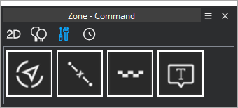
Updates
Favorites Tool
The Favorites tool allows you to add (and remove) features, symbols, models, or signs to a scalable toolbox. Preset and saved custom toolbars can be loaded on-the-fly for various project types. Any custom toolbar can be modified on-the-fly, and you can easily create new ones.
To open the Favorites tool click the “heart” icon on the Quickbar or from the Home ribbon.
Favorites Layout:
- Select and/or edit Custom Toolbars and change icon sizes.
- 2D Symbols
- Signs
- Commands
- History
Populating Favorites - Commands
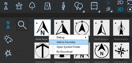
Right-click on any program command and click Add To Favorites.
NOTE – Any items or commands that add to Favorites are automatically stored in the correct sections. This includes: Commands, Signs, and 2D and 3D symbols/models.
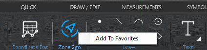
The command appears in the Favorites menu under Commands.

Add multiple commands that help you with your specific workflow.
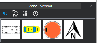
Populating Favorites – 2D Symbols
Right-click any 2D symbol and select Add To Favorites to add the 2D symbol to the 2D section.
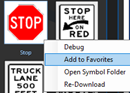
Populating Favorites – Signs
Right-click a sign and select Add to Favorites to add the sign to the Signs section.
Removing Items from Favorites
Right-click a favorite and select Remove to delete it from Favorites.
Organizing Favorites
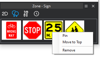
Right-click an item in Favorites and select Pin to move the item to the front/top left or select Move to Top. Pinned items supersede items that are moved to the top. You can also remove items from the dropdown menu.
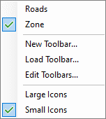
Toolbar Options Menu
From the Toolbar Options menu, you can:
- Choose custom toolbars
- Create new toolbars
- Edit toolbars
- Choose between large and small icons for visibility or space economy.
Creating a new toolbar
When you create a new toolbar, you are prompted to name it. When the toolbar is open, any symbols are commands that you add to Favorites are added to that toolbar.
Editing a toolbar
Click Edit Toolbars to display options for toolbars. You do the following:
New – Create a new toolbar
Duplicate – Duplicate the selected toolbar. This is useful when you want to copy many of the options in an existing toolbar, add/remove/customize the options, and then save the toolbar as a different name.
Rename – Rename the selected toolbar.
Delete – Delete the selected toolbar.
Folder – Open the folder that contains the toolbar .XML files. You can send the toolbars to other FARO Zone users to load (import).
Copy/Paste Multiple Images
From Windows File Explorer, you can select and copy (Ctrl+C) multiple images, and them paste (Ctrl+V) them in your drawing.
Select multiple images and ctrl+C or right click menu to copy.
In Zone, ctrl_V or click the paste button to place all the images.
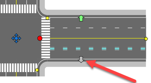
Smart Roads – Lane Add/Remove Grips
You can add or remove road lanes by selecting the outer lane and using the grip. To add lanes, drag the grip toward the road's edge. Drag the grip toward the median to remove lanes.
A.I. Vehicle Detection and Image Cleanup
The satellite image clean-up tool just got a whole lot easier and more fun! This tool uses A.I. functionality to automatically detect and select vehicles in the satellite image. The clean-up tools have also been updated and simplified. Watch this movie and try it for yourself.
NOTE – if you encounter any issues running this feature, please re-start the program and try again.
Bug Fixes
- FZ3-10581 Change Layer Manager "Google Map" > "Satellite Image"
- FZ3-10478 FZ Custom Signs. Saving/Loading is using an absolute path instead of reference.
- FZ3-10786 FZ2 - release version exceptions on this drawing - investigate chair symbols
- FZ3-10700 Agency Builds FZ2D
- FZ3-10755 Translations - String ID issue
- FZ3-10753 PDF transparent images not working - related to PDF white dot issue
- FZ3-10747 CDT and probably HUD edit fields -6'2" -> 5'10" - investigate (Works)
- FZ3-10746 CDT - Tab between fields
- FZ3-10744 Printing - Texture transparency not working
- FZ3-10721 Paste multiple images
- FZ3-10711 Ctrl+V to paste images
- FZ3-10717 PDF white dots on image.
- FZ3-10699 Grid 2D - Axis Isn't resized with grid size change
- FZ3-10106 Airplane mode (no internet) - null reference exception in LibrarySection.cs on startup
- FZ3-9726 FZ2 - remove Import tab from Ribbon - other UI
- FZ3-10709 Ribbon - Intersection Dropdown - Remove new 1 lane templates
- FZ3-10694 Durham - Dropdown / preferences
- FZ3-10670 Intersection - Add grip for changing the lane count
- FZ3-10669 Road - Add grips for changing the lane number
- FZ3-10677 Cleanup Tool - controls missing with 4K 225%
- FZ3-10674 PDF thick lines - Dave Bean - investigate
- FZ3-10671 DLC Content FilesAll.zip - missing thumbs
- FZ3-10664 SVG buttons draw with black background in Start Screen and Google Maps
- FZ3-10659 Durham - Enterprise + Templates
- FZ3-10657 TotalStationDownloader install
- FZ3-10641 Updated icons
- FZ3-10638 Roadways - Add 1 lane either way for each type (include arc, line, intersection)
- FZ3-10620 AI object detection intro
- FZ3-10051 Zone 2D grid snap on launch
- FZ3-10798 Favorites - Models not triggering DLC download if added from the ribbon
- FZ3-10797 Favorites - laundry list
- FZ3-10795 Svg to Png converter - used by Favorites Commands
- FZ3-10792 Favorites - add Commands to Zone 2D
- FZ3-10791 Favorites - save favorites.xml when frmFavorites not open
- FZ3-10788 Favorites - Migrate to Zone 2D
- FZ3-10781 Favorites - Search symbols go to Recent tab
- FZ3-10780 Favorites - Pinned/Unpinned tiles, Remove all but pinned r-click menu command
- FZ3-10784 Favorites - move to favorites.xml
FARO Zone 2D 2023.1 Release Notes - January 2023
What's New
- New look and feel - new icons make features easy to find and identify.
- Updated satellite map tools – Includes simplified tools for searching, tiling, and placing map images. Compare Google and Bing maps side-by-side.
- New start page - The new start page allows you to easily scroll through recent projects and browse the latest articles.
- Smart Roads – Improvements to Smart Roads and roundabouts.
Fixed
- Quick Bubble Label – text value changed when refreshed on first placement
- Snaps – Ortho Snap not working consistently or on top of images
- Distance Marker – round off error when starting at a corner
FARO Zone 2D 2022 and Earlier Release Notes