Combining GeoSLAM App Images With Scans

Overview
This article explains how to combine phone pictures with raw scan in Connect.
Procedure
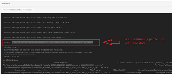
In certain scenarios, when a user tries to combine scan data with pictures taken from the GeoSLAM App phone app in Connect Viewer or in Connect Control Center, the images are not correctly applied.
In Connect Viewer, no error message is displayed.
In Connect Control Centre, the following error occurs: "Insufficient points in data set in delay function".

The error is caused by the phone going into "sleep" mode whilst the GeoSLAM App is running, causing the logging of the trajectory information to pause.
To prevent this:
- Configure the phone to not automatically enter "sleep" or "power saving" mode whilst using the GeoSLAM App.
- Additionally, ensure that the GeoSLAM App is excluded from any power management routines on the phone.
- Please refer to your phone manufacturer's user guide for instructions.
