Control Point File Format for Stop-And-Go Georeferencing in GeoSLAM Connect

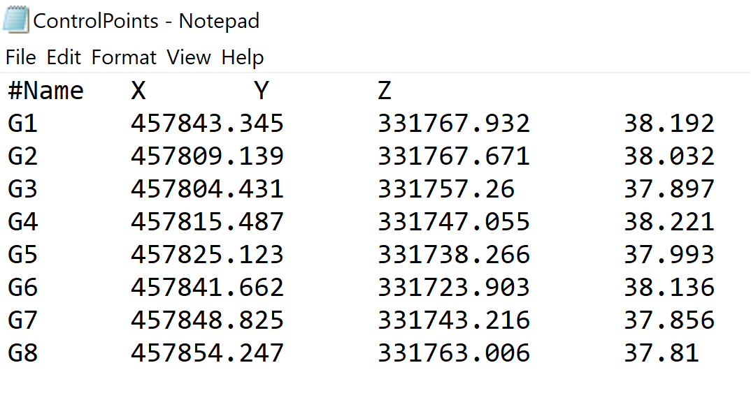
- Control points should be stored in a .txt file with TAB Separation, comma separation or space separation in the following format: Header → #Name X Y Z.
- Control points can also be stored in the .csv file format.
- The file format must be as such:
Please note:
- Control points should be in meters. There is no support for other units (feet, etc).
- Scale factor is not applied. The is the potential for measurement errors on larger distances. If possible, we would recommend to use coordinate systems that are in a local, flat grid.
- Please ensure to delete any additional spaces that may have been added at the beginning and end of each row - this will fail the processing.
- Control point name can consist either from letters, numbers or a combination of both.
- A minimum of five control points are required for georeferencing of stop-and-go datasets.