Creating an Overview Map in SCENE

Overview
Creating an Overview Map or floor plan of a scan project in FARO® SCENE can make visualization and presentation of a scan project much easier.
Creating an Overview Map in SCENE
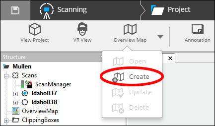
- Open the Overview Map submenu in the Explore ribbon.
- Click Create.
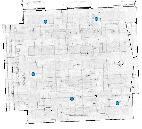
- The overview map shows a top-down view of the scan project with blue dots representing scan locations.
Exporting an Overview Map
- Click Export Overview Map in the Export ribbon.
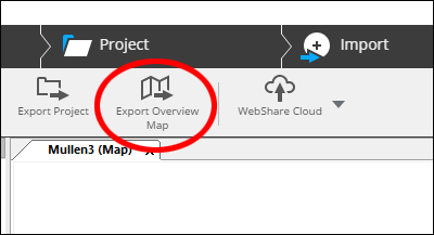
- Overview maps can be exported as TIF or DXF files for use with 3rd party software.
Keyword: tomograph, tomography, floor, plan, slice, thickness, export