FARO Connect Overview
About FARO® Connect Software
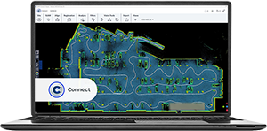
FARO Connect is a software package designed for processing mobile scanner data to create clean, colorized point clouds and visualize point cloud data.
| FARO Connect is designed to fulfill the following requirements: | FARO Connect primarily supports the following FARO and GeoSLAM products: |
|---|---|
|
|
Together with FARO Sphere XG, FARO Stream mobile app and FARO SCENE, FARO Connect provides FARO Orbis users with a powerful eco-system to fulfill their mobile and static reality capture, processing, registration, and sharing needs.

FARO Connect Login
When using FARO Connect for the first time, users will need internet access to create a FARO Sphere XG account. FARO Sphere XG is a cloud environment, which allows the direct upload of captured datasets from Orbis, via the FARO Stream app. Data processed in FARO Connect can be uploaded to Sphere XG, to view, share, and collaborate on point cloud and image data in the Cloud.
The Sphere XG account login credentials are also used for logging into Connect and allow a two-way synchronization and sharing of project data between Connect and Sphere XG.
Homepage
The Connect Homepage provides an overview of all projects that are stored locally, available on a connected Orbis device, or stored within FARO Sphere XG.

In addition, a FARO Sphere XG account, which when coupled with Orbis and the Stream App, provides users with the ability to upload their scan environments when capture is complete. Data in Sphere XG can also be synchronized with Connect, delivering collaboration and sharing capabilities on common projects.
Simplified Processing
Connect provides users with several pre-configured workflows to process datasets based on the user’s requirements.
The 2 main workflows are:
- The Default processing
- The Advanced processing
Default Processing
To process data user will need to select :
- .GEOSLAM file
- Capture environment type
- Optional = Clean data (see below detailed information)
- Optional = Colorize mobile data (see below detailed information)
Example: Default processing

This workflow allows user to import their datasets (.geoslam ) and automatically process them. Please see the steps below explaining the Default workflow options:

- SLAM processing = compute scanner trajectory based on Local SLAM and Global compensation.
- Filters = Specific filters are applied to original point cloud to improve it and remove unwanted points.
- Noise reduction = Improved point cloud overall noise level without compromise on accuracy.
- Colourisation = Add RGB information from the camera to your SLAM point cloud for a better understanding of the captured areas.
- Flash = Extract enhanced colored static scans (.laz) - FARO Orbis and FARO Orbis Premium only.
Advanced Processing
To process data user will need to select :
- SLAM parameters

- Optional = Filters types and parameters

- Optional = FLASH scans

- Optional = Colourisation and image filtering

This workflow provides all the possible processing options. Please see the steps below explaining the Advanced workflow options:

- SLAM processing = Compute scanner trajectory based on Local SLAM and Global compensation.
- Filters = Specific filters are applied to original point cloud to improve it and remove unwanted points.
- Noise reduction = Improved point cloud overall noise level without compromise on accuracy.
- Thinning = It will sample the mobile point cloud with a grid selected by the user. This reduces the total amount of points and keeps only the point cloud density required by the project
- Colourisation = Add RGB information from the camera to your SLAM point cloud for a better understanding of the captured areas.
- Flash = Extract enhanced colored static scans (.laz) - FARO Orbis and FARO Orbis Premium only.
FARO Flash Enhanced Static Scans
Orbis allows users to capture stationary Flash scans. When using the Default processing, the Flash scans are extracted and enhanced using FARO Flash technology to provide cleaner more accurate colorized scans when compared to mobile scans.

Viewer
The Connect Viewer allows users to open and view the project structure and artifacts. Mobile point clouds, static scans, Vision images captured along the scan path and user capture reference points can all be visualized and interacted with.

Captured point clouds can be displayed using RGB or one of several other colorization modes (Elevation, Solid, Intensity, Time)

Point clouds and images can also be visualized together to enable a virtual inspection of the captured environment using the Measurement tools available in the Connect Viewer side toolbar.

Connect Viewer Workflow Bar
The Workflow Bar contains many tools and options to further process or manage the imported project data.

Reprocess
The Reprocess SLAM workflow allows you to define advanced processing parameters to help processing in more challenging capture environments. Typically, you already have processed data using the different preset capture environments, available in the Default workflow at project creation. If this has not provided an acceptable outcome, this workflow allows you to modify parameters before reprocessing SLAM.
Align
The Alignment workflow allows you to align multiple point clouds by providing several tools to manually select and match common user selected points between scans.

A fine alignment process is also available, and this requires that all required scans are closely aligned at the start of the process.
Note: When capturing the data, it is essential that there is at least 30% overlap between captures.
Registration
There are five Registration workflows which allow you to easily align two datasets together, by either:
- using common extracted reflective targets or user measured reference targets, present in both scans
- using extracted reflective targets or user measured reference targets together with the imported georeferenced Control Points of the captured reflective or reference targets.
The Reflective Target Alignment, Reflective Target Georeferencing, and Stop and Go Alignment workflows, use a rigid transformation, meaning the point cloud is transformed using a rigid translation and rotation matrix to best fit the control points from the reference scan.
The Stop and Go Georeferencing workflow can use either a rigid transformation, or non-rigid transformation, meaning the original data is reprocessed using the SLAM algorithm to ensure that the trajectory matches the control points.
Analysis
There are three analysis workflows that can be applied to project dataset, depending upon you output needs.
- Change Detection
When a project has scans (.laz) of the same location, captured at different points in time, using the Change Detection workflow, the point clouds can be compared to establish differences and changes. The output point cloud colorizes objects or surfaces to indicate the changes that have occurred during the period between scans.

- Floorslices
Allows the user to create a scaled .png of a slice through the point cloud at a set height above the floor.

- Static Scans with Flash
This workflow analyses Orbis scans and automatically generates static scans at the positions where the person capturing the scan stopped. The generated scans are enhanced with Flash and color data.
Flash technology enables user to have a similar outcome as any known static scan together with the ability to measure directly on high-resolution panoramic images.

Filters
After you have processed data and confirmed the output, you can apply additional filters to further thin and clean the data. For this purpose, the following workflows are available:
- Noise reduction
With this filter you can improve the point cloud by removing outlying data points.
Example: Noise reduction Filter

- Outlier
With this filter, you can remove outlying data points from the point cloud. Outlying points can be caused by rain or dust or by partial reflections from edges.
Example: Outlier Filter

- Range
With this filter, you can remove less dense and lower accuracy points that exist furthest from the scanner. The points are filtered with respect to their distance from the trajectory.
Example: Range Filter

- Thinning
This filter creates a uniform point cloud and reduces the number of points to reduce the thickness of scanned surfaces based upon either a 2D or 3D grid method defined by the user.
Example: Thinning filter

- Transient
This filter is useful to identify temporary points caused by people or vehicles that are moving past the scanner during acquisition.
Example: Transient Filter

Vision Tools
Users can post process images captured during scanning after importing, using Vision tools:
- Calculate Vision Camera Positions computes the exact position and orientation (Pose) of the camera when the images were taken, which is required to align the point cloud data and the images. This workflow outputs a .gs-vision file.
- Colorize Cloud Using Vision extracts the color information from the equirectangular images and applies it the to the point cloud data, outputting a colorized .laz file with RGB information.
Export
Users can export project artifacts to various formats, allowing them to be imported into other applications, such as FARO SCENE:
- Point cloud .laz can be exported to .e57, .las, .laz, .ply or .txt
- Control points and reference points can be exported to .txt
- Static scans can be exported to .e57 structured format, which can then be imported and analyzed in FARO SCENE.
- Dataset to. E57 format is a specific export that includes your Flash scans as well as embedded high-resolution images and the mobile point cloud bundle in a single file. Users can load the exported .e57 file into other software products, for example FARO SCENE.